

The Branscombe Project


Introduction
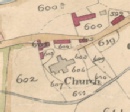
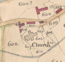
In 1840, as part of a reform of Church of England finances, every parish was surveyed in detail, resulting in ‘tithe maps’ and ‘apportionments’ which list detailed information about each plot of ground.
The Devon Record Office has digitised all the East Devon tithe maps, and has kindly allowed us to host the Branscombe map.
Phil Planel, the East Devon AONB Parishscapes officer, worked with local communities to transcribe all the apportionments. The intention is that, eventually, tithe map and apportionments will be interactive, but it will be a while before this happens. Meanwhile you can study both the Branscombe tithe map and the Branscombe apportionments.
Parishscapes Project
Click here to read about the Parishscapes Project.
Parishscapes was a three year project (2007-
All of Devon’s tithe maps are now on the Devon County Council website here.
The Branscombe tithe map and apportionment can be found here.
Alternatively click here for the tithe map. Note: Its a large file and may take a few moments load.
| Winter Talks |
| Archive Misc |
| Barbara Bender |
| Geoff Squire |
| John Torrance |
| Unpublished Papers |
| Postcard Archive |
| Photographic Archive |
| Talks Page 1 |
| Talks Page 2 |
| Talks Page 3 |
| Talks Page 4 |
| Talks Page 5 |