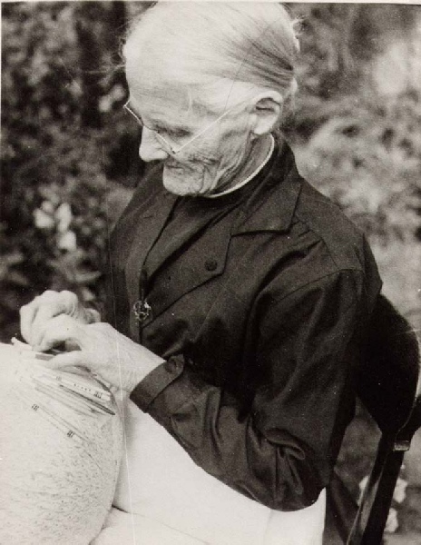


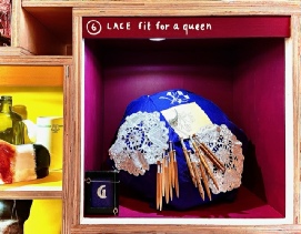
[Box 6] Lace-making got under way in Branscombe in the late seventeenth century, declined by the early nineteenth century, rallied, and finally declined in the 1860s – although, even after the Second World War, a few village lace-makers remained. It has always been a cottage industry and, weather permitting, the women sat outside working their pillows. They had to sell to middle-men, first the Chicks, then the Tuckers, who controlled the industry - and the prices. Even so, lace-making was a thing to be proud of, especially if you helped make lace for the wedding outfits of Queen Victoria or Princess Alexandra.
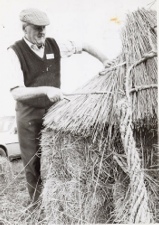
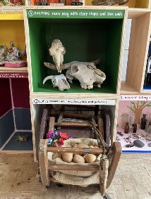
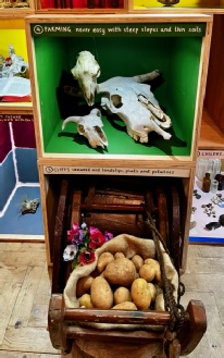
[Box 4] Farming. In Medieval times there were sheep ranges and a cottage industry where the women carded and spun the wool, which was then carted to the fulling mill at Manor Mill, after which the cloth went on its way to Exeter. But the industry died out. Slowly the manorial estate was broken up and farms, small and large, proliferated. Right through to the twentieth century wages were part paid in cider – not great for the domestic economy… In the 1950s there were still 20 farms, and the remaining farmers have to supplement their incomes – with caravan parks or contract work. Manor Mill has responded to the new environmental urgencies by farming organically and encouraging biodiversity.
[ps: We couldn’t find a local cow skull – the one on display looks more like an American steer than a peaceful Branscombe cow!]
Branscombe - ‘History in the Making’
A dozen and more boxes… six thousand years and more… objects that reflect past and present. The stories chosen are often less about people with means and power - big land-owners, church dignitaries - and more about villagers getting on with their lives … just getting by.
Page 1
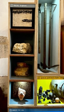
[Box 1] Rock in place … You can’t box up landscape - the deep valleys to the east, the plateau to the west, cliffs and long shingle beach to the south – but much of it is created by Branscombe’s wonderfully varied geology, and, from the start, people recognized the different qualities of the rocks and found ways to work with them.
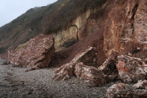
[A] Red Mudstone (over 200 million years old) is found at the base of the cliff to the east of Branscombe Mouth and makes up almost the entire cliff to the west. It’s good for making bricks. When the great land-owner John Stuckey died in 1810, an inventory of his estate mentioned a field called Brick field, and a stack of 5000 bricks. They were probably made from mudstone quarried from Weston coombe.
[B] Within the Mudstone are intrusions of gypsum – most easily seen beyond the chalets west of the Sea Shanty. It can be made into Plaster of Paris and there were times when it fetched a good price. In the 1850s, William Wheaton set up a gypsum mill close to the beach. It wasn’t a great success. A small section remains near the Sea Shanty.
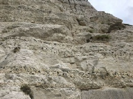
[C] Next comes Upper Greensand (100 million years old). Most clearly visible in Hooken undercliff. Great for building. Look closely behind many of the old houses in the village and you’ll see evidence of quarrying.
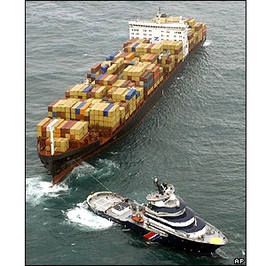
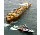
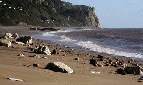
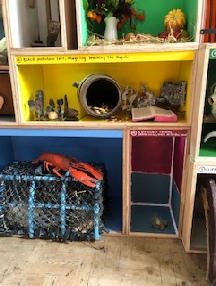
[Box 2] Beach. A busy place! Stone-age people foraged for flint; men fished or came ashore with smuggled goods; cliff-farmers cut seaweed off the rocks in winter; coal boats came in from Wales; boys collected pebbles that were used in the production of toothpaste, paint, and pottery. Most recently, the great container ship, the Napoli, at risk of breaking up, was run aground at Branscombe. In time-honoured fashion, people, local and ‘from away’, scavenged the shore.
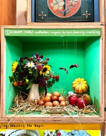
[Box 5] Climate change. Nowadays farm houses have become separated from their land and are mainly private dwellings. In response, organic small-holdings have taken up ‘in between’ bits of land – chickens and eggs, flowers and veg, sheep and cattle, succulents. But it’s a precarious way of life and very dependent on local support.
[D] Within the green sandstone are layers of reddish chert. Stone-age farmers generally preferred flint, but sometimes they used chert.
[E] Next, Lower Limestone (Chalk. 80 – 100 million years old). Fine-grained, excellent for mullions, window traceries, carvings - Exeter Cathedral … the East window of Branscombe Church... The Romans opened up the Beer quarry caves, and it’s been worked and reworked down the centuries.
[F] Chalk with flint is clearly visible above the Greensand in the Undercliff. Prehistoric farmers and earlier gatherer-hunters knew a good thing when they saw it. The gathered flint nodules from the beach, maybe even shinnied down the cliffs, or dug pits … and made a great range of tools – scrapers, points, arrowheads, axes. Some were traded down-the-line to places as far away as Bodmin Moor.
Much later, in the eighteenth century, it became the vogue to spread lime on fields in order to break up the claggy clay. They burnt the chalk-with-flint in lime kilns and carted the lime away. Look hard at a map, and you’ll see that almost every outcrop of chalk, small or large, was exploited. Look hard on the ground and you’ll see the remains of quarrying, spills of flints, derelict kilns ... Some of the flints were picked over and used for building, or made into flint-locks for pistols, or skilfully squared to create decorative house facades.
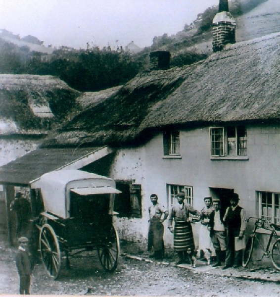
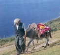
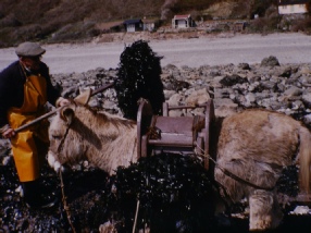
[Box 3] Cliffs. This donkey-crub and tools were used by Cliffy Gosling. He was one of the last cliff-farmers. A map of 1763 shows a few cliff plats at Littlecombe Shute, but mostly they date to the nineteenth century and first half of the twentieth. To the west of Branscombe Mouth, plats were created by smaller and larger land-slips; to the east, the great landslide of 1792 created a long spit of land below the cliffs. Farm-labourers, trying to find ways to feed their families, paid smal rents for them. The heat of the sun coming off the cliffs created a warm micro-environment, and seaweed from the shore fertilised the crops. As transport improved and markets opened, the cliff-farmers took their early potatoes, veg and flowers to Sidmouth and Exeter and even sent them on their way to London. It was hard work and after the Second World War the plats started to go out of use. Some of the donkey linhays became holiday homes.
Today, with rising sea levels, violent storms, and the effects of groyne building further down the coast, cliff and plat are eroding…